

DES MOINES, Iowa—The National Weather Service Office in Des Moines has updated information about the potential for hazardous weather for the next couple of days. Several rounds of storms are possible early Tuesday through at least midweek. Severe storms and locally heavy rain are possible at times.
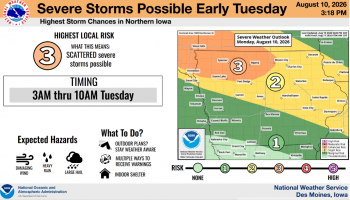
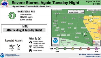
First and the highest threat will be early Tuesday (3am-10am) and in northern Iowa. Damaging wind gusts are the primary threat but isolated instances of large hail and locally heavy rain are possible. Chances for strong to severe storms remain through much of central Iowa on Tuesday night and again Wednesday afternoon to evening, but each day depends somewhat on the previous one.




(contributed information, NWS)
About the Author